Global Coral Reef Allen Coral Atlas
Global coral reef habitat maps were created in 2021 and let by the UQ team in collaboration with an international partnership through the Allen Coral Atlas.
Locations
Global Coral Reefs
People
Chris Roelfsema, Stuart Phinn, Eva Kovacs, Mitchell Lyons, Nick Murray, Emma Kennedy, Kathryn Markey, Chantel Say, Alex Ordonez, Carolina Castro, Meridith Roe, Paul Tudman, Jeremy Wolff, Rodney Borrego-Acevedo, Daniel Harris, Doddy Yuwono, Atefeh Sansoleimani
Partner Researchers
Greg Asner, Paulina Gerstner (Carnegie Institution /Arizona State University), Helen Fox, Brianna Bambic, Zoe Lieb (National Geographic Society), Kirk Larsen (Vulcan) and Andrew Zolli (Planet).
Timeframe
2018 - 2022
Funding agency
Vulcan (Paul Allen Philanthropies) and Great Barrier Reef Foundation
Summary
Globally, coral reefs cover roughly 1% of the ocean seafloor. Despite covering such a small spatial extent of our oceans, corals reefs are home to approximately 25% of all marine species and roughly 500 million people rely on these natural wonders for food, shelter and other important services and goods. Unfortunately, coral reefs are increasingly impacted by climate change, coastal development and overfishing. To ensure adequate decision-making regarding reef conservation, we require detailed habitat maps from regional to global scales.
The global coral reef mapping project provides these maps, and since 2021, they have been publicly accessible through the Allen Coral Atlas.
As part of the Allen Coral Atlas, the University of Queensland team took up the challenge to develop the methods and create detailed habitat maps using a consistent and open-source mapping approach to create a single map that describes geomorphic zonation (e.g., slope, flat, crest) and bottom composition (e.g., coral, algae, sand) over the full extent of the world’s coral reefs. The mapping approaches are based on previous research by the University of Queensland on the Great Barrier Reef and other reefs in the Asia-Pacific.
The Allen Coral Atlas is an international partnership, initiated and funded through Paul G. Allen’s Philanthropic organisation (i.e., Vulcan) with the mission to create the world’s first global mapping and monitoring system of coral reefs.
The founding partners included: Planet, who provided the global Planet Dove imagery; the Carnegie Institution / Arizona State University, who developed and applied the methods for image pre-processing as well as the bleaching and turbidity monitoring protocol; the National Geographic Society, who led global engagement; and The University of Queensland, who developed the field verification methods, led the verification activities and conducted the actual mapping. All maps, imagery and water depth data are publicly accessible through www.AllenCoralAtlas.org.
The habitat maps have since been downloaded and used for various purposes, see examples.
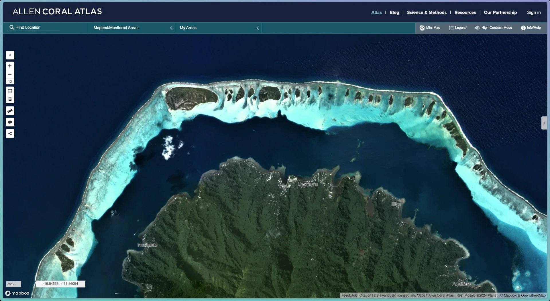
A screenshot from the Allen Coral Atlas, showing the satellite imagery of a reef surrounding one of the Leeward Islands.
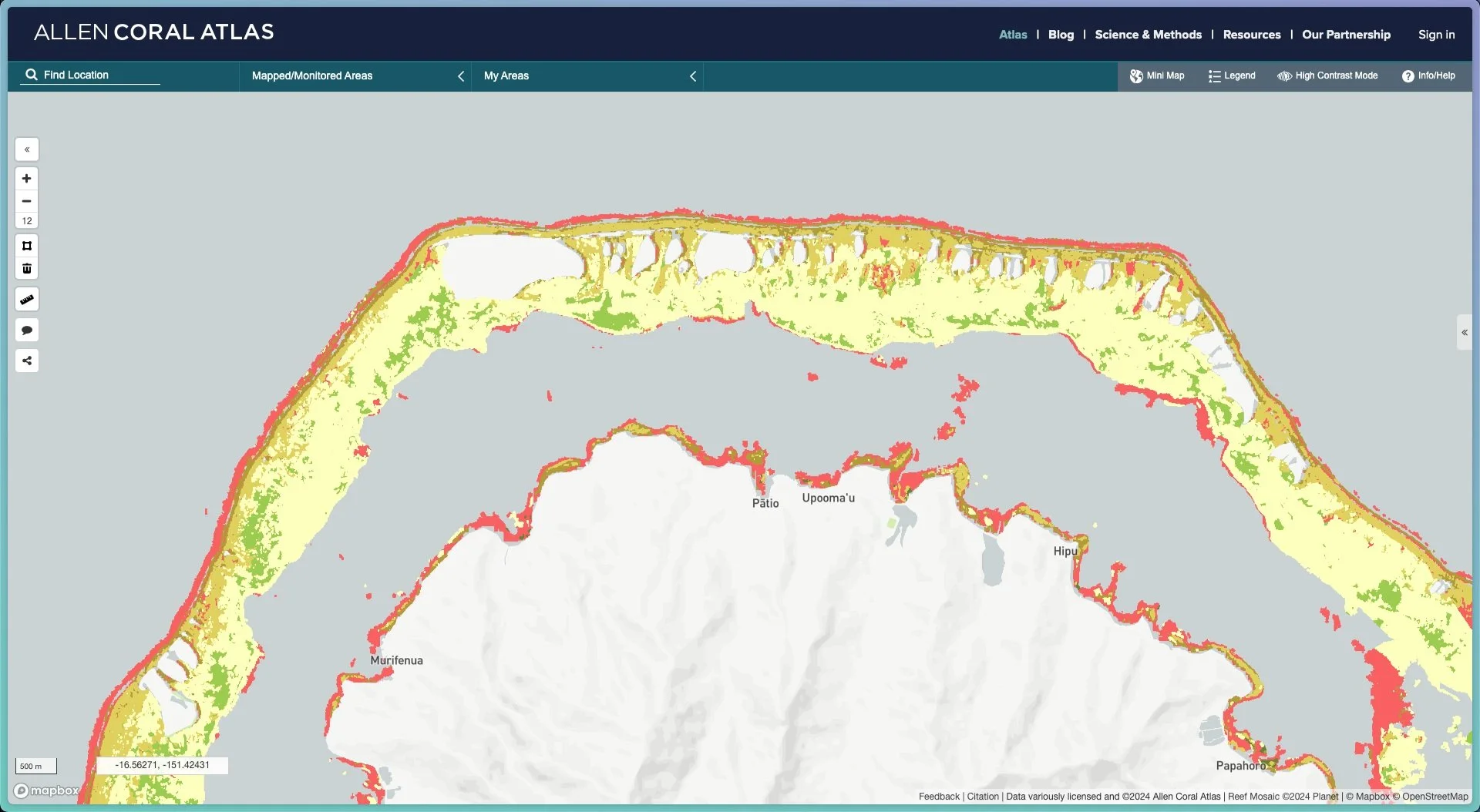
A screenshot from the Allen Coral Atlas, showing the benthic habitat of a reef surrounding one of the Leeward Islands.
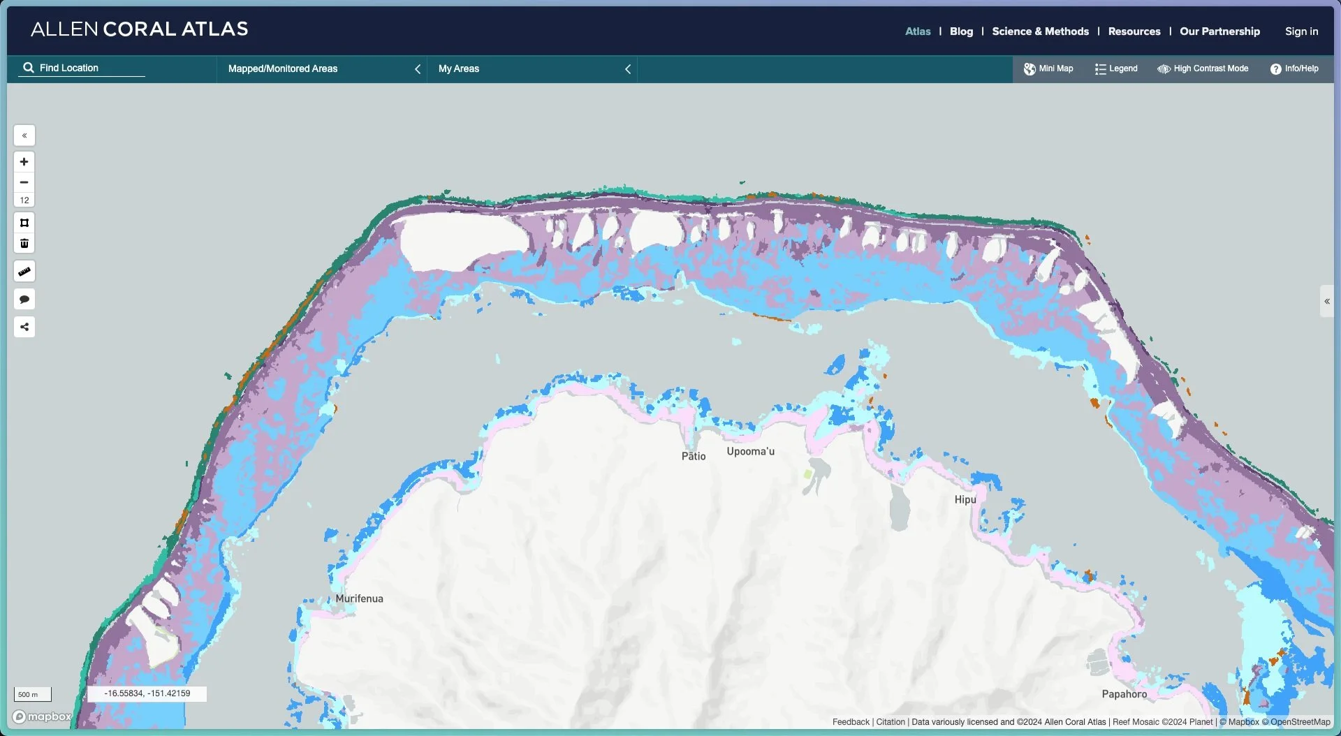
A screenshot from the Allen Coral Atlas, showing the geomorphic zones of a reef surrounding one of the Leeward Islands.
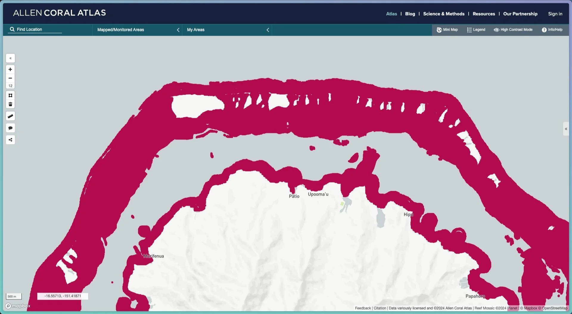
A screenshot from the Allen Coral Atlas, showing the reef extent of a reef surrounding one of the Leeward Islands.
Publications
Scientific journals
Rivera-Sosa, A., A.I. Muñiz-Castillo, B. Charo, G.P. Asner, C.M. Roelfsema, S.D. Donner, B.D. Bambic, A.G. Bonelli, M. Pomeroy, D. Manzello, P. Martin, and H.E. Fox, (2025) Six decades of global coral bleaching monitoring: a review of methods and call for enhanced standardization and coordination. Frontiers in Marine Science, https://doi.org/10.3389/fmars.2025.1547870
Lyons M., NJ Murray, EV Kennedy, EM Kovacs, C Castro-Sanguino, SR Phinn, R Borrego Acevedo, A Ordoñez Alvarez, J Wolff, C Say, P Tudman, K Markey, M Roe, RF Canto, HE Fox, B Bambic, Z Lieb, GP Asner, PM Gerstner, DE Knapp, J Li, M Skone, E Goldenberg, K Larsen, and CM Roelfsema (2024) New global area estimates for coral reefs from high-resolution mapping. https://doi.org/10.1016/j.crsus.2024.100015
Murray, N.J.; Bunting, P.; Canto, R.F.; Hilarides, L.; Kennedy, E.V.; Lucas, R.M.; Lyons, M.B.; Navarro, A.; Roelfsema, C.M.; Rosenqvist, A.; Spalding, M.D.; Toor, M.; Worthington, T.A. (2022) CoastTrain: A Global Reference Library for Coastal Ecosystems. Remote Sens. https://doi.org/10.3390/rs14225766
Kennedy E, C Roelfsema, M Lyons, E Kovacs, R Borrego-Acevedo, M Roe, S Phinn, K Larsen, N Murray, D Yuwono, J Wolff, P Tudman (2021) “Reef Cover: a coral reef classification system for global habitat mapping from biophysical remote sensing” Nature and Scientific data https://doi.org/10.1038/s41597-021-00958-z
Roelfsema, C. M., M. Lyon, N. Murray, K. E., E. Kennedy, K. Markey, R. Borrego-Acevedo, A. Ordonez Alvarez, C. Say, P. Tudman, M. Roe, J. Wolff, D. Traganos, G. Asner, B. Bambic, B. Free, Z. Lieb, H. E. Fox and R. S. Phinn (2021). "Workflow for the generation of expert-derived training and validation data: A view to global scale habitat mapping." Frontiers in marine Science: Special Issue Remote Sensing for Applied Coral Reef Science and Management. https://doi.org/10.3389/fmars.2021.643381
Li, J, Knapp, DE., Lyons, M, Roelfsema, C, Phinn, S, Schill, SR. and Asner, GP. (2021). Automated global shallow water bathymetry mapping using Google Earth Engine. Remote Sensing, https://doi.org/10.3390/rs13081469
Roelfsema, C.M.; Lyons, M.B.; Castro-Sanguino, C.; Kovacs, E.M.; Callaghan, D.; Wettle, M.; Markey, K.; Borrego-Acevedo, R.; Tudman, P.; Roe, M.; Kennedy, E.V.; Gonzalez-Rivero, M.; Murray, N.; Phinn, S.R. (2021) How Much Shallow Coral Habitat Is There on the Great Barrier Reef? Remote Sens. https://doi.org/10.3390/rs13214343
Li J, D.E. Knapp, N.S. Fabina, E.V. Kennedy, K. Larsen, M.B. Lyons, N.J. Murray, S.R. Phinn, C.M. Roelfsema, G.P. Asner. (2021), A global coral reef probability map generated using convolutional neural networks. Coral Reefs https://doi.org/10.1007/s00338-020-02005-6
Lyons, M, CM. Roelfsema, EV. Kennedy, EM. Kovacs, R Borrego-Acevedo, K Markey, M Roe, DM. Y, DL. Harris, SR. Phinn, G Asner, J Li, DE. Knapp, NS. Fabina, KLarsen, D Traganos, NJ. Murray (2020) Mapping the world's coral reefs using a global multiscale earth observation framework. Frontiers in Ecology and the Environment. https://doi.org/10.1002/rse2.157
Roelfsema, C. and S.R. Phinn (2010) Calibration and Validation of Coral Reef Benthic Community Maps: Integration of Field Data with High Spatial Resolution Multi Spectral Satellite Imagery. Journal of Applied Remote Sensing, https://doi.org/10.1117/1.3430107.
Scientific Data
Roelfsema, Chris; Borrego-Acevedo, Rodney; Canto, Robert; Harris, Daniel; Kennedy, Emma; Kovacs, Eva; et al. (2021). Benthic and Geomorphic Reference Data for Global Coral Reef Mapping. figshare. Collection. https://doi.org/10.6084/m9.figshare.c.5233847.v6
Habitat Maps for Any Reef Globally Download from www.allencoralatlas.org
Reef Extent
Geomorphic Zonation,
Benthic Composition
Bathymetry
Planet Satellite mosaic


